
Gabrieleno Trail, Angeles National Forest – 24 April 2009 – Part Two
Leave a comment
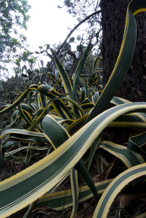
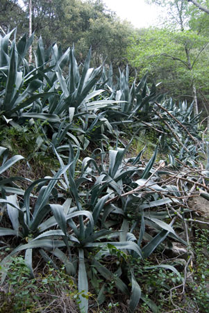
Throughout the late 19th and early 20th centuries immigrants new to the Los Angeles Basin colonized the foothills of the San Gabriel Mountain Range with cabins, lodges and tourist camps. Floods in the 1930s washed most of these structures away, but stone staircases, river-rock walls and exploded gardens of Agave americana gone 80 years feral remain.
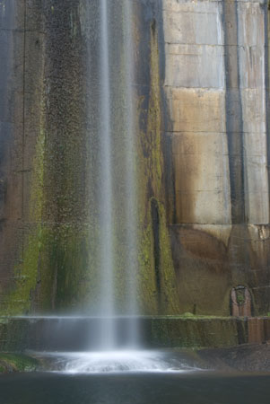
The Arroyo Seco runs through these ruins for most of the year: Perhaps the most idyllic effect of that era of human habitation is the modest waterfall formed by the 50-foot tall debris dam found at the end of a faded trail that runs north from the Paul Little Picnic Area.
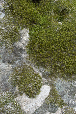
Though it tapers off as it flows down toward Pasadena and the grounds of the Jet Propulsion Laboratory, the creek cuts a riparian canyon lush with mosses, oaks and sycamores through these hills — hills that are just the beginning of the vast wilderness of the Angeles National Forest — north of the Gould Mesa campground.

The Gabrielino Trail runs almost 30 miles from Pasadena’s Jet Propulsion Laboratory to Chantry Flats, winding its way through the turn-of-the-19th Century human ruins that litter the front range of Southern California’s San Gabriel Mountains. A kind of “hiking boom” in the 1890s had gentleman wood-walkers rambling about these hills with their fancy moustaches and OG L.L. Bean gear, building huts, cabins, bridges and dams.

Most spectacular among these intrusions into the wilderness is the work of Professor Thaddeus Lowe. An entrepreneur and self-trained scientist, Lowe spent the Civil War years doing aerial reconnaissance of Confederate positions from a balloon. He moved to Pasadena, CA in 1887, started a bank and in 1893 opened a railway that scaled up 3,250-foot high Echo Mountain, where he’d constructed a chalet. Several years later he opened another hotel and tavern on the mountain. By 1905 the mountains had rejected all of these structures, destroying them by way of fire and flood. All that remains are a few cement foundations and an abandoned train tunnel, along with the decaying roadways and stone walls that are peppered throughout this wilderness that abuts the affluent suburbs that spread east along the foothills.
I returned to seek the Royal Gorge on a hot Saturday afternoon, the first weekend of July. The Gabrielino Trail is an easy walk for the first few miles as its an old road. Bridges with truck-weight specifications span the lively creek, thick glades shade the trail and stonemasonry juts out of the hillsides: terraced gardens of agaves that mark old campgrounds and graffiti-marked foundations of what look to be houses. Occasionally the trees are scarred with more graffiti, the older it is the higher it lies on the trunk.
Another classic from On The Natural:
 |
My first attempt at the Royal Gorge, a swimming hole in the front range of the San Gabriel Mountains of Southern California, ended with me squealing like a pig and scrambling like a goat over the rocks, logs and boulders of Long Canyon. I’d failed to reach the gorge itself; I decided to turn back while suspended on a rock wall over a murky pool of algae-choked water. I’d just hurled my walking stick over the pool and was unbuckling my pack to throw that as well, intending to leap after these accessories and continue the quest. I paused for a minute and watched a California Newt paddling in the muck below. Read More
